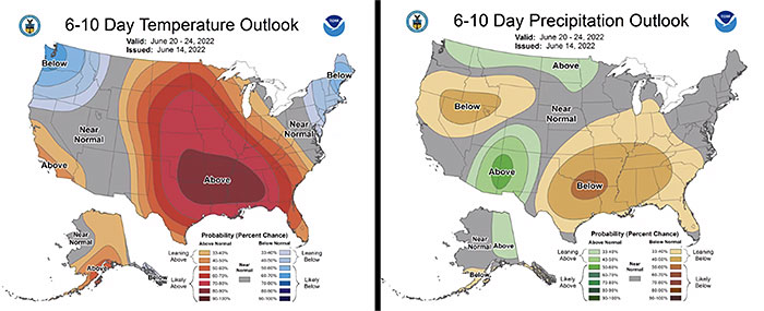
June is turning into an interesting month. The heat and dryness experienced over the last few days is predicted to continue through at least June 24 (Figure 1). Conditions resemble more of a late July or early August, not June.

Figure 1 Forecasted temperature and precipitation accumulation through June 24, 2022. Maps generated by NOAA - https://www.cpc.ncep.noaa.gov
South central and southeast Missouri are starting to experience some dryness. Currently, surface water supplies are adequate. However, yesterday, evapotranspiration rates were estimated at about 0.3", which is a lot of water getting removed from the ground and vegetation into the air. Increases in evapotranspiration rates are driven by sunshine, high temperatures, humidity and winds. If current conditions persist as forecasted, conditions will deteriorate quickly, and we will likely start seeing stresses to forages and row crops.
There are examples of pattern changes in early July, such as 2016. June 2016 was hot and dry. Patterns changed in July and crops recovered well. However, there are also examples where conditions from June persist throughout the summer.
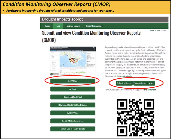
If drought conditions persist, please consider helping us track drought over this growing season by visiting the Drought Impacts website and documenting observations and impacts of drought at your field (Figure 2). Reports are used to educate decision-makers on current impacts of drought.

Figure 2 Share the impacts of drought on your field by visiting https://droughtimpacts.unl.edu/Tools/ConditionMonitoringObservations.aspx and submitting a report.
For real-time weather data visit the Missouri Mesonet website (mesonet.missouri.edu). The website includes soil temperatures, air temperatures, precipitation and more information collected from our routinely-maintained weather stations.
Cover image of thermometer and sun courtesy of pixelliebe via Shutterstock.